55+ trails across 9 counties — with parking, trailheads, and amenities — in one app that fills in as you cover the network. Made in Charlotte.
Join the Society — free betaFree beta · iPhone · 2-minute setup
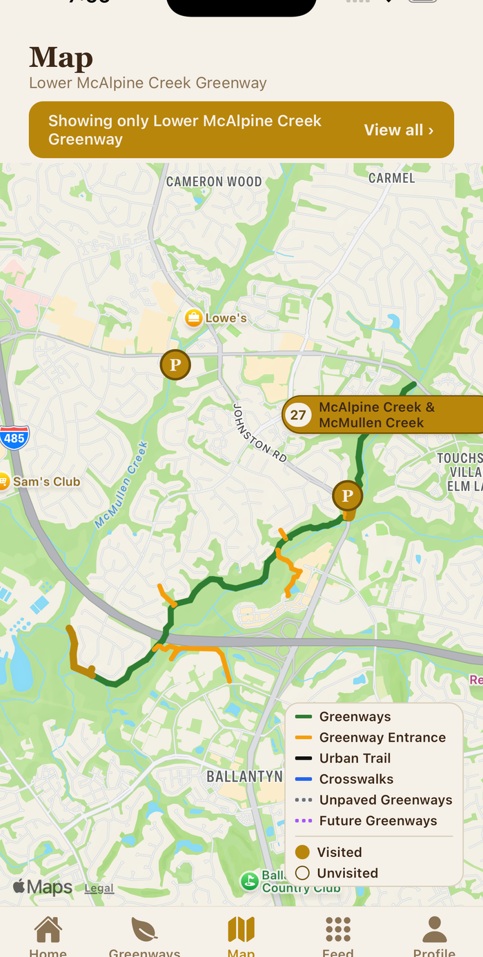
Every trail line drawn to match the official county greenway brochure.
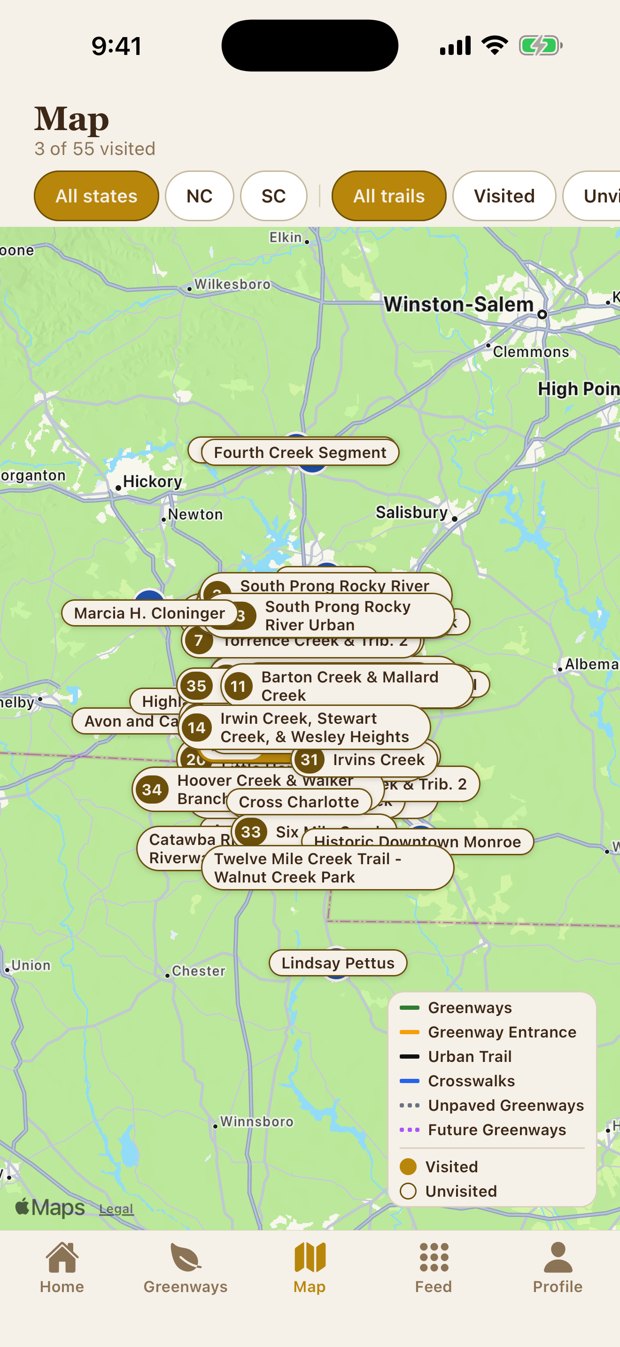
Record a walk, run, or ride with whatever you already use — Apple Watch, Garmin, Fitbit, Strava, or just your phone. Import it, and the exact stretches you covered turn gold on your map, with a completion percentage for every trail. Cover them all, and you've walked Charlotte.
No more guessing where a trail starts, where to park, or how far it goes.
Every lot mapped, per trail. Tap an address and it opens in Maps with turn-by-turn directions to the trailhead.
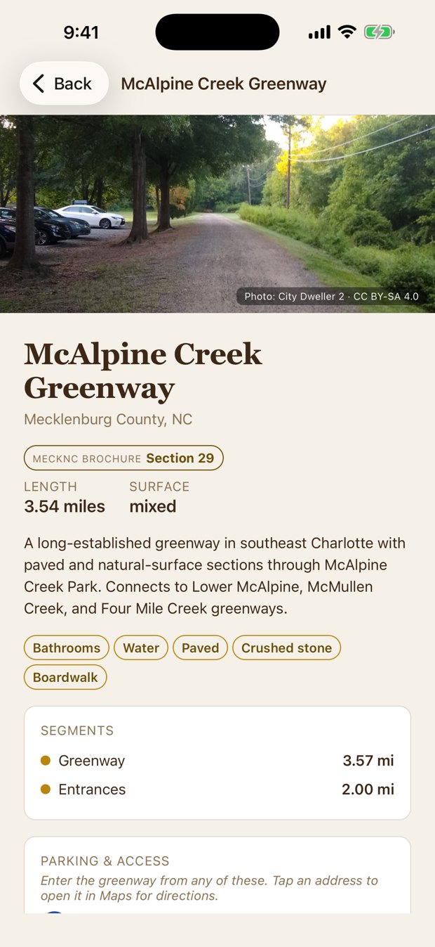
Every greenway, trailhead, and parking lot, mapped to match the official brochure.
Length, surface, amenities, and how to get there for each trail.
Track the walks, runs, and rides you have done, and earn trophies along the way.
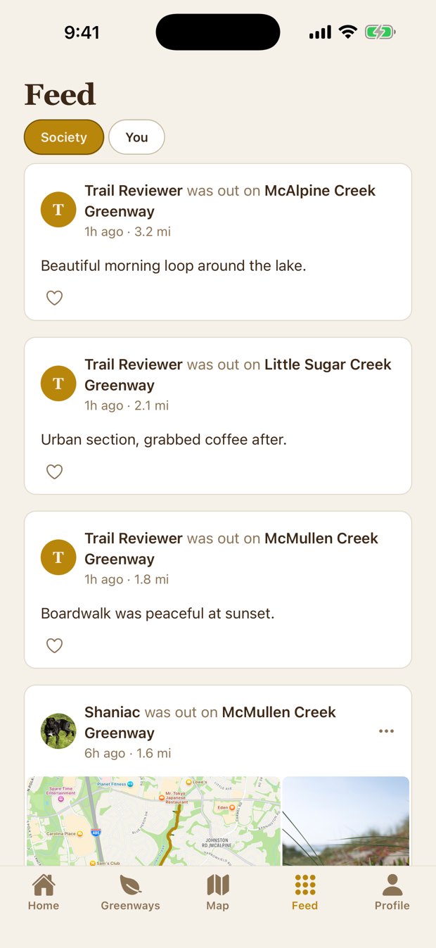
See recent visits across the network from other walkers, runners, and riders.
Focused on the Charlotte metro greenway system, growing as new sections open.
Real screens from the app — the gold coverage map, a trail with parking and photos, and the community feed.
The app is in beta on Apple TestFlight. It is free, and you can install it on any iPhone.
Taps open an email — just send the word SOCY and your invite arrives within a day.
Android? Leave your email and we'll let you know.
Any watch, phone, or fitness app that saves workouts to Apple Health works — Apple Watch, Garmin, Fitbit, Strava, Nike Run Club, and more.
Every one mapped with its route, parking, and amenities:
Anne Springs Close Greenway · Antiquity Greenway · Avon and Catawba Creeks Greenway · Barton Creek Greenway · Briar Creek Greenway · Caldwell Station Creek Greenway · Caldwell Station Tributary Greenway · Campbell Creek Greenway · Catawba River Trail at Riverwalk · Clarks Creek Greenway · Cross Charlotte Trail · Dye Creek Greenway · Four Mile Creek (Matthews) & Tributaries Greenway · Four Mile Creek Greenway · Hector H. Henry II Greenway · Highland Rail Trail · Historic Downtown Monroe Greenway · Hoover Creek Greenway · Huntersville Downtown Greenway · Irish Buffalo Creek Greenway · Irvins Creek Greenway · Irwin Creek Greenway · Lindsay Pettus Greenway · Little Hope Creek Greenway · Little Sugar Creek Greenway · Long Creek Greenway · Lower McAlpine Creek Greenway · Mallard Creek Greenway · Marcia H. Cloninger Rail Trail · McAlpine Creek Greenway · McDowell Creek Dirtway · McDowell Creek Greenway · McIntyre Creek Greenway · McIntyre Creek Tributary Greenway · McMullen Creek Greenway · Plum Creek Greenway · Six Mile Creek Greenway · South Prong Rocky River Greenway · South Prong Rocky River Tributary Greenway · South Prong Rocky River Urban Trail · Statesville Greenway - Fourth Creek Segment · Statesville Greenway - Gregory Creek Segment · Stewart Creek Greenway · Stewart Creek Tributary 2 Greenway · Taggart Creek Greenway · Toby Creek Greenway · Torrence Creek Greenway · Torrence Creek Tributary Greenway · Twelve Mile Creek Greenway · Twelve Mile Creek Trail - Walnut Creek Park · Walker Branch Greenway · Wesley Heights Greenway · West Branch Rocky River Dye Creek Connector · West Branch Rocky River Greenway · West Branch Rocky River Tributary Greenway
Don't see your favorite greenway? Tell us and we'll look into adding it — route, parking, and all. We're growing the map across the Charlotte region and beyond.
Greenway Pass Socy is an independent community project built by Shane Edwards, a Charlotte chiropractor who got tired of explaining where to park. Read the story →